Understanding Photogrammetry, Orthomosaic Mapping, and Thermal Imaging
Meta Description: Understanding Photogrammetry, Orthomosaic Mapping, and Thermal Imaging – A clear, practical guide to modern aerial mapping and site analysis using drones and sensors.
Introduction
In today’s data-driven world, the ability to accurately capture and interpret information about the physical environment is vital. Technologies like photogrammetry, orthomosaic mapping, and thermal imaging have transformed how we observe and analyze landscapes, structures, and infrastructure.
Used in construction, energy, agriculture, and environmental sectors, these tools offer powerful insights from above — revealing both visible and invisible details of a site. This article offers a clear, practical explanation of how these technologies work, what they produce, and how they are applied.
1. What Is Photogrammetry?
Photogrammetry is the process of obtaining precise measurements and spatial information from photographs. When applied with drones or aerial cameras, photogrammetry allows for the creation of 2D maps and 3D models of real-world environments.
How It Works:
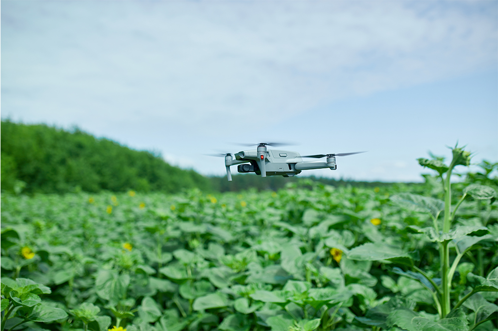
A drone captures multiple overlapping photos of a site.
Specialized software identifies shared features between images.
These features are used to reconstruct 3D geometry and spatial relationships through a process called Structure-from-Motion (SfM).
The end result is a series of geospatial outputs — including point clouds, elevation models, and orthomosaics — that can be used for analysis, measurement, and decision-making.
2. What Is an Orthomosaic Map?
An orthomosaic is a large, high-resolution image created by stitching together many aerial photos. Each image is corrected for lens distortion, camera angle, and terrain elevation, resulting in a map that is:
True to scale
Geographically accurate
Suitable for measurement
Why It Matters:
Unlike a single drone photo, an orthomosaic map enables professionals to:
Measure distances and areas accurately
Monitor site changes over time
Integrate mapping data into GIS and CAD systems
Orthomosaics are used in land surveying, construction site planning, agriculture, and environmental monitoring.
3. What Is Thermal Imaging in Aerial Mapping?
Thermal imaging captures infrared radiation rather than visible light. Every object emits heat, and thermal sensors detect these differences, producing images where hotter objects appear brighter.
How It’s Used:
Mounted on drones, thermal cameras can capture:
Temperature variations across large surfaces
Heat leaks in roofs or walls
Hot spots in solar panels
Wildlife or people through vegetation or in darkness
These images can also be stitched into thermal orthomosaics — geo-corrected heat maps that show the temperature distribution of an entire site.
4. Key Photogrammetry and Thermal Outputs
Output – What It Provides
Orthomosaic (RGB): A high-resolution, distortion-free visual map
Thermal Orthomosaic: A geo-accurate heat map showing temperature differences
Point Cloud: A dense 3D representation of surfaces and structures
Digital Surface Model: Elevation model including trees, buildings, and terrain
Digital Terrain Model: A “bare earth” model with vegetation and structures removed
Radiometric TIFF: Pixel-level thermal data used for temperature measurement
5. Applications Across Industries
Construction & Infrastructure:
Monitor progress with recurring aerial surveys
Detect insulation gaps using thermal imagery
Map topography and earthworks using DSMs and DTMs
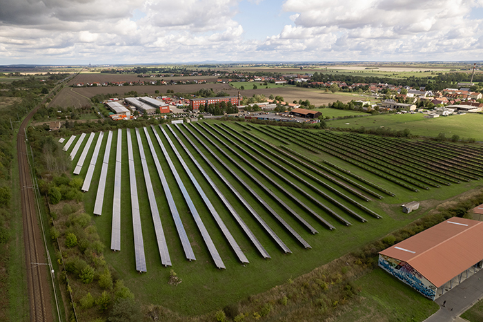
Energy:
Inspect solar panels for performance issues
Identify overheating electrical components
Model terrain for renewable energy site planning
Agriculture:
Evaluate crop health through heat and moisture variation
Assess irrigation effectiveness
Map field elevation for drainage planning
Environmental Monitoring:
Track vegetation and wildlife with minimal disturbance
Monitor land erosion or changes in terrain
Detect thermal anomalies in remote or sensitive areas
6. Benefits and Limitations
Benefits:
Non-invasive: Data is collected without disrupting the site
Efficient: Large areas can be mapped quickly
Accurate: High-resolution data suitable for analysis and reporting
Multi-layered: Visual and thermal layers offer deeper insights
Limitations:
Weather-dependent: Cloud cover, wind, and sun affect data quality
Thermal interpretation requires understanding of surface properties
Dense vegetation may obscure the ground in photogrammetry
7. How These Technologies Work Together
By combining photogrammetry, orthomosaic mapping, and thermal imaging, it’s possible to create a comprehensive overview of a site — showing both its physical form and its thermal behavior.
For example, a construction team could:
Use orthomosaics for measuring site layout and excavation zones
Generate a DSM to understand elevation changes
Apply thermal imaging to detect HVAC inefficiencies or leaks
The integration of these layers enhances situational awareness and enables data-driven decisions.
8. Example of Industry Use: SkyMesh 3D
SkyMesh 3D is one example of a company that specializes in aerial mapping using these technologies. The team uses drones equipped with both RGB and thermal sensors to:
Capture high-resolution images for orthomosaic generation
Build accurate 3D models of terrain and structures
Produce radiometric thermal maps for analysis and reporting
SkyMesh 3D’s workflows follow industry best practices for accuracy and reliability, and their outputs are used in construction monitoring, site planning, and asset inspection.
While the tools and methods described in this article are used globally, SkyMesh 3D applies them specifically within professional-grade aerial survey environments, delivering data products that meet the demands of engineers, planners, and analysts.
Conclusion
Photogrammetry, orthomosaic mapping, and thermal imaging are more than just modern tools — they’re essential technologies that transform how we view and manage the world around us. When used effectively, they offer unmatched precision, scale, and efficiency.
Whether you’re mapping a field, inspecting a solar array, or monitoring environmental change, these aerial methods bring powerful insights down to earth.